
Search Packages
Search by destination, activity and trip duration
per person


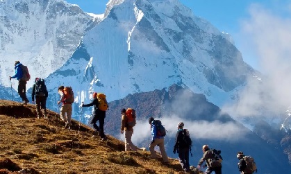
Upper Dolpo Trek is one of the most remote regions of Nepal. The Upper Dolpo trek is an ideal destination for trekkers looking for a physical challenge and a stunning wilderness adventure in a tranquil, pristine and mysterious high-altitude region.The Upper Dolpo trekking route passes many gigantic mountain ranges of Mt. Annapurna, Dhaulagiri and Kanjiroba, to name but a few and passes through Lower Dolpo, at one time a small Kingdom in its own right. There’s no denying that the Upper Dolpo trek is one of the harder and longer treks in Nepal, with several camps situated above 4500 meters and some high passes. But, this makes it ideal for experienced trekkers on a return trip to Nepal who is looking for a new challenge and fresh sights. Upper Dolpo’s main international claim to fame is being featured in Peter Matthiessen’s classic travel memoir, The Snow Leopard. It is well worth reading if heading to Dolpo. Trekkers are enthused greatly about the wild remoteness, the stunning mountain scenery and the fact that the local people had that innocent friendliness peculiar to people who live in excessively remote mountainous regions in this trekking route.
Upper Dolpo is a restricted area, for which a fee is charged of US$ 500 for the first 10 days, and US$ 50 for each additional day. The relatively high trekking permit fee limits the number of trekkers that visit Upper Dolpo, making this trek a very special and exclusive experience. The Trek begins with a flight from Kathmandu to Nepalgunj about 45 minutes and next morning flight ends at Jhupal. This trek is best to do in the summer and monsoon season. Winter seasons is avoided for this trek because of the heavy snowfall. The people living Upper Dolpo region number only a few hundred and are among the world's highest dwellers. Upper Dolpo trek route goes through various passes, rivers, and monasteries. The prayer flags, stupa, the Tsyorten, and Mani stones are visible during the journey. Moreover, the views of mountains are visible during the trip.The villages in Upper Dolpo are 4,300m and above. This is only the place that the people still practice the pre-Buddhist Bon Po religion. This early sect was almost entirely replaced after Buddhist doctrine began to spread across Tibet in the 9th century. The abundance of Himalayan wildlife, including, Musk Deer, Himalayan Blue Sheep and rare Snow Leopard, makes it an Eco-trek destination as well.
The first English subtitled movie on Dolpo “The Caravana” or “The Himalaya” of Nepal was a huge success and was nominated for the Oscar Award in the best foreign language film category. Boundaries of the Shey Phoksundo Park include within 3,500 square kilometers of land, mostly above 4,000 meters.
A number of acclimatization days are built into itineraries in Upper Dolpo, as well as contingency days. Flights are often delayed or canceled, so extra days are added. If you don’t encounter any delays, these days will be used on the trek for side trips.
Upon arrival at Kathmandu, you will greet and welcome by our agency’s representative in front of Arrival gate and then transfer to your Hotel.
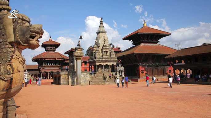
Today after breakfast we will start a guided tour to several of the most historical and spiritual attractions in Kathmandu. Some of these landmarks are considered World Heritage Sites; including the historic Hanuman Dhoka Durbar Square, the sacred Hindu temple of Pashupatinath, the famous 'Monkey Temple' (Swoyambhunath) and Buddhists shrine Bouddhanath the large Stupa within the world. Briefing regarding the trek with two way question answer with the trip leader (The Guide). In the evenining you will walk along the Thamel streets which is a good place to buy trekking equipment.
Generally we go via Nepalgunj to get to Dolpo so, firstly we will fly to Nepalgunj and spent food time in Nepalgunj. Nepalgunj is situated in south western part of Nepal a steaming hot city. Comparatively, it is warmer than Kathmandu. Nepalgunj lies near the Indian border. It is a plain land hesitated by different people from different parts of the country and which in culture and heritages. It includes Bageshowri temple, Nepal's one of the important Hindu temples.
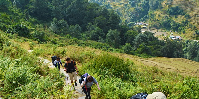
After a pleasant overnight at Nepalgunj, early morning transfer to airport for the 45 minute flight to Juphal over the Himalayan foothills, with views of Annapurna and Dhaulagiri peaks to the north. On arriving at Juphal our trekking staffs will receive you, who have walked all the way from Nepalgunj with the camping gear and food supply taking 5-6 days. Here at Juphal a short 2-3 hrs walk from the airstrip leads to our overnight camp at Dunai village. Our first day adventure begins with an hour downhill walk through the village below the airstrip, then leading through the terraced fields to the Bheri River and the narrow gorge taking 2-3 hours to camp at Dunai. This is a much larger village or small township, with a new hospital and it is administrate headquarter of the Dolpo region. Here we have ample time for leisure walk around the village.
We leave Dunai and cross a suspension bridge and turn to the west following a trail past a hospital. The trail ascends up the side of the treeless, Thulo Bheri valley before entering Phoksundo river valley. During the walk we get to the view of Kagmara Peak up the valley. We pass through walnut groves, Dhera and Rahagaun villages, walk down dense jungles and finally reach Ankhe. Overnight in Ankhe.
The path from this camp leads to small ups and downs along the forested riverbed, then ascending steeply to about 2,900m. The ups and downs can begin to get a bit monotonous, but there are several streams along the way that offer a chance to cool off. The trail eventually leaves the forests and traverses a grassy slope high above the river. You can almost look down between your toes to see the fast-flowing river below. After reaching the river at 2,950m, the trail becomes a collection of rocks and sticks that form a dyke along the river bank. Journey continues upstream to a bridge near Ryajik village for the overnight camp 3,500m.
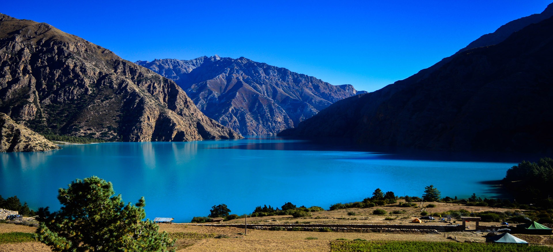
Journey continues along the valley floor to the confluence of the Phoksundo and Pungmo Kholas. After crossing to the western side of the Phoksundo Khola on a wooden bridge the path follows to the west bank of the Pungmo Khola which leads all the way to Phoksundo Lake 3,500m near Ringmo village. The path passes through a cedar forest and finally to Palam, a winter settlement used by the people of Ringmo village. From here our route heads up to open country, at an altitude of around 3,350m. From the ridge one can see the distant views of Phoksundo Lake and a spectacular 300m high waterfall, one of the highest in Nepal. After a brief stop here with the great views, finally the walk descent through birch forests to the upper reaches of the Phoksundo Khola, and then to the picturesque settlement of Ringmo with its mud plastered chortens and Mani walls. From here it is a short walk to the shores of Phoksundo Lake for the overnight at camp.
A well-deserved rest day free from packing, at Phoksundo we can go for a short hike to the village of Ringmo and its Tibetan Buddhist Monastery is well worth a visit.
You follow the trail that skirts the edge of the lake itself. This precarious trail is suspended on a gangway of wood supported on pegs, driven into crevices in the rocks and signals the remoteness of the area you are about to enter. You go very steeply up, to 4,040meters, and then plunge down again to the valley bottom to enter the flood plain of the Phoksundo Khola and trek to your night stop alongside the river, within the confines of the forest to avoid the worst of the wind which is prevalent in the valley bottom.
Today's first hour walk leads along the level path through a glacial valley that now heads due north. At the confluence of the Phoksundo Khola and another mountain stream, there is an old wooden bridge. Here taking the barely distinct path to the north-east of the valley. There is no trail as such, so it is necessary to clamber over the rocks and boulders and to ford a stream that rushes down the steep valley. A long climb brings us to a sheep meadow where the trail veers up a steep ravine. A hard climb to the top brings to yet another valley where one can see the Kang-La pass which will lead towards Shey Gompa. Overnight camp will be just before the pass in a place that Peter Matheson christened 'Snowfields Camp'.
The trail goes inclined steeply for first 2 and half hours over Sandy Mountain to Kang-La with an elevation of 5350 meters. The feet slid at every step, and altitude sickness may take hold at this point. After walking down the hill from the pass for about 4 hours, we get to Shey Gompa.
This is one of the long and difficult days during the trek. Today we cross the highest pass during this trek where you may feel difficult but can be seen a great view takes 6-7 hrs and after top at Numala we will descends another bottom part known as Phedi and overnight.
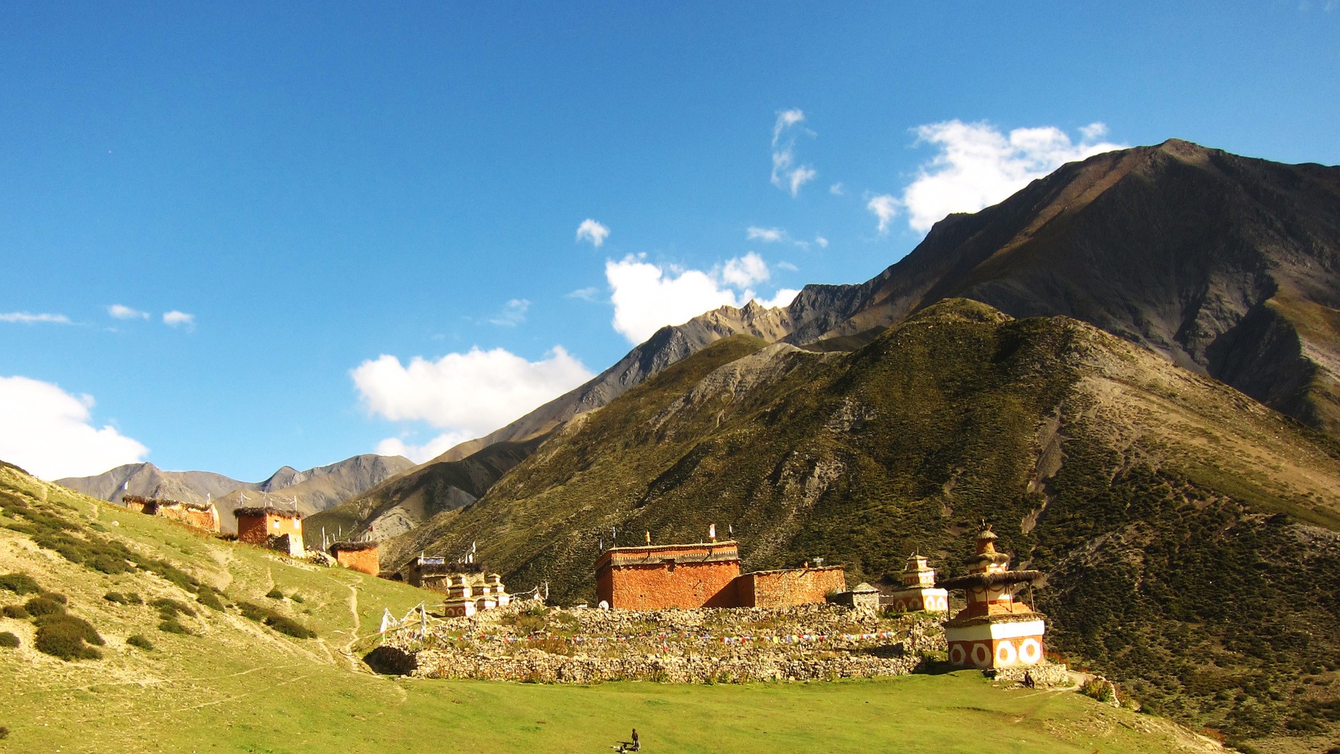
Another well-earned rest day for local hike around Shey meaning crystal, this monastery is also known as the Crystal Mountain (well described in Peter Matheson classic novel Snow Leopard). The lama of Shey resides at a red hermitage known as Tsakang Gompa which is north of Shey. It is rather a retreat than a monastery.
We begin the day by following a pleasant trail amidst juniper trees which descends into a grey, stony canyon. Then the path begins to zigzag over bare rocks and coarse eroded soil until it eventually brings us to the top of Saldang-la pass. The subsequent descent towards the north is long and tiring but grazing yaks and sheep, and nomadic tents made from yak hair is a comforting sight. In Namduna Gaun we visit Namgung monastery. The red stone monstery is built against the backdrop of a cliff on the north wall of a gorge. Overnight in Namuda Gaun.
On leaving the Namduna Gaun our route leads to a climb up a screw slope. Further on it begins a long traverse along some dusty barren mountains. After 3-4 hours of hard climb, Saldang 3,620m/ 11,874ft appears below on a plateau high above the Nam Khongmala. It has a picturesque appearance. Saldang is the largest village of the inner Dolpo area. Though the village lies at about the same altitude as Ringmo it is totally different then Ringmo, a Himalayan village is situated below the tree line while Saldang belongs to the arid zone of the Trans-Himalayan Tibetan plateau.
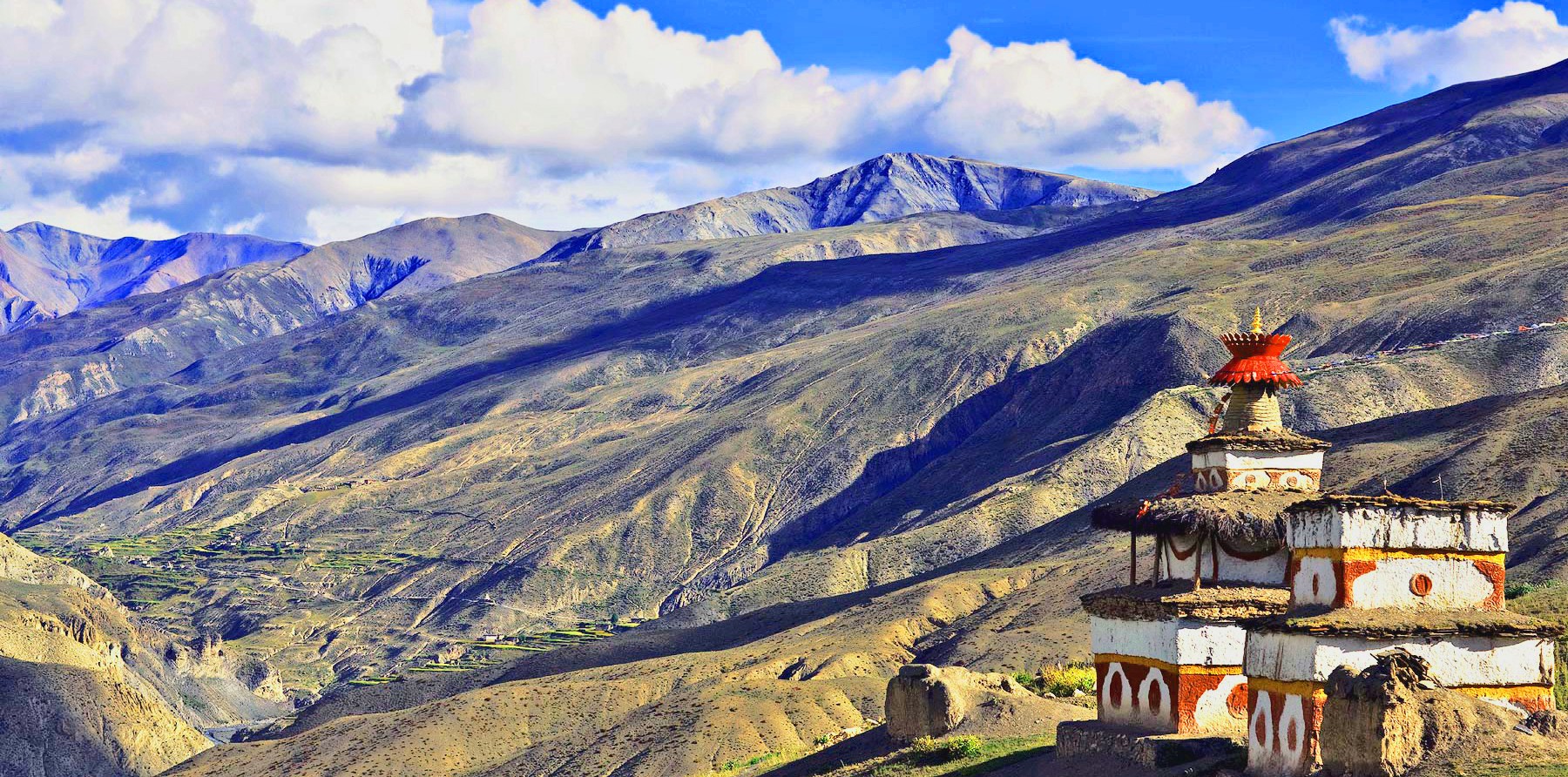
After leaving Saldang on the way down to the river bed you pass through terraced fields, Stupas, Chortens, heaps of Mani stones and a Chaiba monastery. Namdo, the next village is also prosperous with sixty houses having nearly four hundred inhabitants. It stretches for more than 5km on the high slopes to the left of Nam Khong Khola. The Namdo monastery is located near the river bed. There is also another monastery on top of a high cliff. You camp near the small Settlement of Sibu, right on the river bank.
This is the last pass of the journey, mentality requires preparing. We walk up mild horizontal along a river site. We cross the river twice at some point of the trail for a long stretch. But towards ends become steeper. As we left valleys and villages enter to the barren hill, an almost highest camp of the journey.
We get up early in the morning and set forth on today’s trek. It will take us two long hours to reach the top of the Jeng La pass from where we get remarkable views of the north face of the Dhaualgiri massif. From here we descend on a rough trail to the Tarap Valley, a fascinating valley with vast plains in high mountains that extends twenty kilometers along Tarap Chu River. We camp close to the monastery at Tokyu.
Today, the route leads eastward along the downhill course of Tarap Chu in a plain valley with patches of lush verdant grass on both sides of the river which is completely different from other parts of inner Dolpo. There is also a marsh which is a common feature in the Desert Mountains of Tibet and the Ladakh Himalaya. In this valley both Bon Po and Chaiba sects reside together in harmony. After a short trek on this beautiful valley we come to Dho Tarap (4,040m/13,251ft) for the overnight camp with ample time to visit around the villages. This village is surrounded by an irregular stone wall. At Dho, about 40 houses are divided into three clusters and built in a haphazard way inhabited by few Tibetans and mostly Magars hill tribe of Nepal who have lived here for many generations.
You leave Dho Tarap by the new suspension bridge and then walk alongside the river, sometimes going very high before reaching down to the water again. Some of the going is quite demanding and one bridge, said to have unusable for six years, necessitates crossing on wet stepping-stones. Coming into the broad fertile valley of the Barbung Chu, you walk amongst the various crops of millet, sweet corn, barley, buckwheat, green beans, chillies and marijuana. Your lunch and night stop is high above the river but there is a standpipe for water.
This morning again continues down the gorge of the Tarap River, at times alongside it, rising high above on a trail built from the steep slopes might come across people from Dolpo taking their herds to lower pastures for the winter. There are many possible campsites by the river. This will be one of the exciting days of this trip walk, as the valley becomes so narrow in a deep gorge that in some places we can jump from one side to another. Sometimes there is no trace of any path and we have to walk across stone slabs fitted on logs in between the walls which act as a bridge. The gorge also provides unexpected adventure and thrills. At some places, the bridges are either damaged or washed away and we may be forced to cross the icy torrent on foot. Finally, reaching to the camping spot beside the Tarap Khola at Khanigaon (3,150m) we stop for overnight stay.
Leaving Khanigoan by the new suspension bridge and then walk alongside the river, sometimes going very high before reaching down to the water again. Some of the trail is quite demanding and one bridge, said to have been out for six years, necessitates crossing on wet stepping-stones. Tarakot is an old fortress town known by the local people as Dzong, meaning 'fort'. Before the Gorkha dynasty Tarakot was the capital and had a dzong. The famous Sandul Gompa, which lies 8km east of Tarakot and at the junction of Barbung Khola and Tarap Chu, stands on a knoll to the south of Bheri river and at one time supervised collections of tolls for the trading caravans traversing an area called Tichu Rong.
In total 5-6 hours, today’s walk continues beside the Bheri River in a tremendous gorge with pine trees and an ingenious path built about seven meters above the river. Our trail will continue alongside the big Bheri Rriver ascending until the Byas Gadi. From here the trail moves towards the west on a relatively easy trail. On reaching Dunai (2,140m) after completing the circuit with time for celebration, particularly as bottled beers is available in Dunai or else try the local brew.
We retrace the journey back to Jhuphal from Dunai in 2-3 hours, which is a short distance walk along the Bheri River to the small airstrip for the last overnight camp with full board of this great memorable adventure. Initially the way is flat but the final hour up to your destination seems steeper. It has pretty little villages such as and the track is not too .This makes a nice circuit and avoids having a repeat part of the outward trek
Early morning 35 minutes sweeping wonderful flight to Nepalgunj over the Himalayan foothills, overlooking stunning views of the snowcapped peaks including Annapurna and Dhaulagiri to the north. On arrival at Nepalgunj depending upon the connecting flight schedule to Kathmandu. If it is in the afternoon have time for few hours’ refreshment in the comfort of some Hotels at Nepalgunj. Then connect with the flight back to Kathmandu.
The day can occupy as security day in case of flight interruption. This pleasant day you may have full day at leisure at your own or can be extends your extra trip with us on additional cost or time to explore the Thamel for last day shopping and evening company will meet you for the farewell dinner. You can spend the day getting ready for your next day’s flight, do some souvenir shopping, or if there is a place is Kathmandu that you really want to visit.
Our adventure in Nepal comes to an end today! Today is your departure day, we will drop you to the International airport to catch your flight back to your home and pray for your Safe journey.


Upper Dolpo Trek itinerary is information as possible about this trip. However, if you want to discuss itinerary, Potter, exclude and include of this trip for your suitability please contact us by email. info@enlightentrip.com Enlightentrip Pvt. Ltd always think about client’s safety and comfort. Upper Dolpo trekking is an adventure tour where we reach remote mountain regions, can observe diversified cultures and go through some of scenic beauty of the nature. But sometimes there might be some unwanted situations like natural disaster, change in weather condition of that region and change in health condition of the members, which would be beyond our control so we cannot guarantee safety based on these situations. Please note that trekking guide has an authority to cancel any part of trekking on above itinerary if it is necessary due to safety concerns. Otherwise trekking group leader follow above itinerary for Upper Dolpo Trek.
We help you enjoy your holidays in Nepal with different activities like trekking, tour, hiking, etc. Remember us for best services at very reasonable prices.
Find Us On


 (+977)-9851018595
  info@enlightentrip.com
 Gokarneshwor, Jorpati, Kathmandu